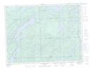
Maps showing Loon Lake, Algoma, Ontario
Loon Lake is a Lake located in Algoma, Ontario and has an elevation of 339 meters.
- Latitude: 48° 11' 50'' North (decimal: 48.1972222)
- Longitude: 84° 12' 37'' West (decimal: -84.2102777)
- Topography Feature Category: Lake
- Geographical Feature: Lake
- Canadian Province/Territory: Ontario
- Elevation: 339 meters
- Location: Algoma
- Atlas of Canada Locator Map: Loon Lake
- GPS Coordinate Locator Map: Loon Lake Lat/Long
Loon Lake NTS Map Sheets