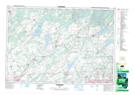
Maps showing Loughborough Lake, Frontenac, Ontario
Loughborough Lake is a Lake located in Frontenac, Ontario and has an elevation of 132 meters.
- Latitude: 44° 26' 48'' North (decimal: 44.4466666)
- Longitude: 76° 24' 26'' West (decimal: -76.4072222)
- Topography Feature Category: Lake
- Geographical Feature: Lake
- Canadian Province/Territory: Ontario
- Elevation: 132 meters
- Location: Frontenac
- Atlas of Canada Locator Map: Loughborough Lake
- GPS Coordinate Locator Map: Loughborough Lake Lat/Long
Loughborough Lake NTS Map Sheets