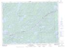
Maps showing Louisa Falls, Rainy River, Ontario
Louisa Falls is a Falls located in Rainy River, Ontario and has an elevation of 431 meters.
- Latitude: 48° 7' 52'' North (decimal: 48.1311111)
- Longitude: 91° 21' 55'' West (decimal: -91.3652777)
- Topography Feature Category: Falls
- Geographical Feature: Falls
- Canadian Province/Territory: Ontario
- Elevation: 431 meters
- Location: Rainy River
- Atlas of Canada Locator Map: Louisa Falls
- GPS Coordinate Locator Map: Louisa Falls Lat/Long