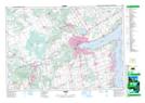
Maps showing Lovers Creek, Simcoe, Ontario
Lovers Creek is a River located in Simcoe, Ontario and has an elevation of 237 meters.
- Latitude: 44° 22' 33'' North (decimal: 44.3758333)
- Longitude: 79° 39' 1'' West (decimal: -79.6502777)
- Topography Feature Category: River
- Geographical Feature: Creek
- Canadian Province/Territory: Ontario
- Elevation: 237 meters
- Location: Simcoe
- Atlas of Canada Locator Map: Lovers Creek
- GPS Coordinate Locator Map: Lovers Creek Lat/Long