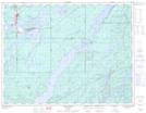
Maps showing Lower Flat Rapids, Thunder Bay, Ontario
Lower Flat Rapids is a Rapids located in Thunder Bay, Ontario and has an elevation of 325 meters.
- Latitude: 49° 43' 18'' North (decimal: 49.7216666)
- Longitude: 86° 31' 19'' West (decimal: -86.5219444)
- Topography Feature Category: Rapids
- Geographical Feature: Rapids
- Canadian Province/Territory: Ontario
- Elevation: 325 meters
- Location: Thunder Bay
- Atlas of Canada Locator Map: Lower Flat Rapids
- GPS Coordinate Locator Map: Lower Flat Rapids Lat/Long