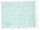
Maps showing Lower Lola Lake, Ontario
Lower Lola Lake is a Lake located in Ontario.
- Latitude: 48° 24' 12'' North (decimal: 48.4032999)
- Longitude: 84° 35' 40'' West (decimal: -84.5944000)
- Topography Feature Category: Lake
- Geographical Feature: Lake
- Canadian Province/Territory: Ontario
- GPS Coordinate Locator Map: Lower Lola Lake Lat/Long
Lower Lola Lake NTS Map Sheets