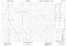
Maps showing Lower Milogamau Creek, Cochrane, Ontario
Lower Milogamau Creek is a River located in Cochrane, Ontario.
- Latitude: 50° 39' 36'' North (decimal: 50.6600000)
- Longitude: 80° 58' 24'' West (decimal: -80.9733333)
- Topography Feature Category: River
- Geographical Feature: Creek
- Canadian Province/Territory: Ontario
- Location: Cochrane
- Atlas of Canada Locator Map: Lower Milogamau Creek
- GPS Coordinate Locator Map: Lower Milogamau Creek Lat/Long
Lower Milogamau Creek NTS Map Sheets