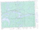
Maps showing Lower Shebandowan Lake, Thunder Bay, Ontario
Lower Shebandowan Lake is a Lake located in Thunder Bay, Ontario and has an elevation of 438 meters.
- Latitude: 48° 36' 46'' North (decimal: 48.6127777)
- Longitude: 90° 10' 20'' West (decimal: -90.1722222)
- Topography Feature Category: Lake
- Geographical Feature: Lake
- Canadian Province/Territory: Ontario
- Elevation: 438 meters
- Location: Thunder Bay
- Atlas of Canada Locator Map: Lower Shebandowan Lake
- GPS Coordinate Locator Map: Lower Shebandowan Lake Lat/Long
Lower Shebandowan Lake NTS Map Sheets