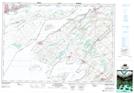
Maps showing Lucas Point, Frontenac, Ontario
Lucas Point is a Cape located in Frontenac, Ontario and has an elevation of 74 meters.
- Latitude: 44° 10' 44'' North (decimal: 44.1788888)
- Longitude: 76° 29' 43'' West (decimal: -76.4952777)
- Topography Feature Category: Cape
- Geographical Feature: Point
- Canadian Province/Territory: Ontario
- Elevation: 74 meters
- Location: Frontenac
- Atlas of Canada Locator Map: Lucas Point
- GPS Coordinate Locator Map: Lucas Point Lat/Long
Lucas Point NTS Map Sheets