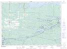
Maps showing Lunge Lodge, Nipissing, Ontario
Lunge Lodge is a Unincorporated area located in Nipissing, Ontario and has an elevation of 212 meters.
- Latitude: 46° 9' 37'' North (decimal: 46.1602777)
- Longitude: 80° 1' 31'' West (decimal: -80.0252777)
- Topography Feature Category: Unincorporated area
- Geographical Feature: Locality
- Canadian Province/Territory: Ontario
- Elevation: 212 meters
- Location: Nipissing
- Atlas of Canada Locator Map: Lunge Lodge
- GPS Coordinate Locator Map: Lunge Lodge Lat/Long