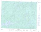
Maps showing Macauley Lake, Thunder Bay, Ontario
Macauley Lake is a Lake located in Thunder Bay, Ontario and has an elevation of 446 meters.
- Latitude: 48° 49' 57'' North (decimal: 48.8325000)
- Longitude: 89° 10' 24'' West (decimal: -89.1733333)
- Topography Feature Category: Lake
- Geographical Feature: Lake
- Canadian Province/Territory: Ontario
- Elevation: 446 meters
- Location: Thunder Bay
- Atlas of Canada Locator Map: Macauley Lake
- GPS Coordinate Locator Map: Macauley Lake Lat/Long
Macauley Lake NTS Map Sheets