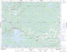
Maps showing Mafeking Lake, Kenora, Ontario
Mafeking Lake is a Lake located in Kenora, Ontario and has an elevation of 392 meters.
- Latitude: 49° 56' 11'' North (decimal: 49.9363888)
- Longitude: 93° 7' 10'' West (decimal: -93.1194444)
- Topography Feature Category: Lake
- Geographical Feature: Lake
- Canadian Province/Territory: Ontario
- Elevation: 392 meters
- Location: Kenora
- Atlas of Canada Locator Map: Mafeking Lake
- GPS Coordinate Locator Map: Mafeking Lake Lat/Long
Mafeking Lake NTS Map Sheets