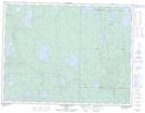
Maps showing Mount Magee, Thunder Bay, Ontario
Mount Magee is a Mountain located in Thunder Bay, Ontario and has an elevation of 387 meters.
- Latitude: 49° 12' 17'' North (decimal: 49.2047222)
- Longitude: 88° 34' 28'' West (decimal: -88.5744444)
- Topography Feature Category: Mountain
- Geographical Feature: Mount
- Canadian Province/Territory: Ontario
- Elevation: 387 meters
- Location: Thunder Bay
- Atlas of Canada Locator Map: Mount Magee
- GPS Coordinate Locator Map: Mount Magee Lat/Long
Mount Magee NTS Map Sheets