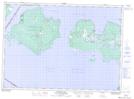
Maps showing Magnetic Reefs, Manitoulin, Ontario
Magnetic Reefs is a Shoal located in Manitoulin, Ontario.
- Latitude: 45° 50' 27'' North (decimal: 45.8408333)
- Longitude: 83° 19' 33'' West (decimal: -83.3258333)
- Topography Feature Category: Shoal
- Geographical Feature: Reefs
- Canadian Province/Territory: Ontario
- Location: Manitoulin
- Atlas of Canada Locator Map: Magnetic Reefs
- GPS Coordinate Locator Map: Magnetic Reefs Lat/Long