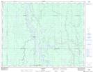
Maps showing Maher, Cochrane, Ontario
Maher is a Unincorporated area located in Cochrane, Ontario and has an elevation of 244 meters.
- Latitude: 49° 27' 26'' North (decimal: 49.4572222)
- Longitude: 81° 9' 17'' West (decimal: -81.1547222)
- Topography Feature Category: Unincorporated area
- Geographical Feature: Railway Point
- Canadian Province/Territory: Ontario
- Elevation: 244 meters
- Location: Cochrane
- Atlas of Canada Locator Map: Maher
- GPS Coordinate Locator Map: Maher Lat/Long