Canada Topographic Maps

Manfred Lake Topo Maps

Topography maps and Latitude/Longitude Location

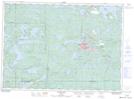
Maps showing Manfred Lake, Ontario

Manfred Lake is a Lake located in Ontario.

  • Latitude: 46° 30' 15'' North   (decimal: 46.5042000)
  • Longitude: 82° 40' 0'' West   (decimal: -82.6667000)
  • Topography Feature Category: Lake
  • Geographical Feature: Lake
  • Canadian Province/Territory: Ontario
  • GPS Coordinate Locator Map: Manfred Lake Lat/Long

Manfred Lake NTS Map Sheets

041J07 Elliot Lake Topographic Map at 1:50,000 scale

041J10 Rawhide Lake Topographic Map at 1:50,000 scale

041J Blind River Topographic Map at 1:250,000 scale

 
Buy Topographic Maps DVD
Newsletter Sign-up

Yes, I want to receive map store discounts.


Bookmark and Share