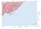
Maps showing Maple Leaf Creek, York, Ontario
Maple Leaf Creek is a River located in York, Ontario and has an elevation of 171 meters.
- Latitude: 43° 42' 21'' North (decimal: 43.7058333)
- Longitude: 79° 29' 52'' West (decimal: -79.4977777)
- Topography Feature Category: River
- Geographical Feature: Creek
- Canadian Province/Territory: Ontario
- Elevation: 171 meters
- Location: York
- Atlas of Canada Locator Map: Maple Leaf Creek
- GPS Coordinate Locator Map: Maple Leaf Creek Lat/Long