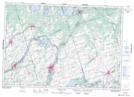
Maps showing Marsh Point, Hastings, Ontario
Marsh Point is a Cape located in Hastings, Ontario and has an elevation of 114 meters.
- Latitude: 44° 15' 22'' North (decimal: 44.256111)
- Longitude: 77° 36' 49'' West (decimal: -77.6136111)
- Topography Feature Category: Cape
- Geographical Feature: Point
- Canadian Province/Territory: Ontario
- Elevation: 114 meters
- Location: Hastings
- Atlas of Canada Locator Map: Marsh Point
- GPS Coordinate Locator Map: Marsh Point Lat/Long
Marsh Point NTS Map Sheets