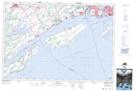
Maps showing Marys Cove, Prince Edward, Ontario
Marys Cove is a Bay located in Prince Edward, Ontario and has an elevation of 84 meters.
- Latitude: 44° 2' 28'' North (decimal: 44.0411111)
- Longitude: 76° 54' 8'' West (decimal: -76.9022222)
- Topography Feature Category: Bay
- Geographical Feature: Cove
- Canadian Province/Territory: Ontario
- Elevation: 84 meters
- Location: Prince Edward
- Atlas of Canada Locator Map: Marys Cove
- GPS Coordinate Locator Map: Marys Cove Lat/Long