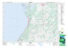
Maps showing Maryville Lake, Bruce, Ontario
Maryville Lake is a Lake located in Bruce, Ontario and has an elevation of 226 meters.
- Latitude: 44° 35' 33'' North (decimal: 44.5925000)
- Longitude: 81° 13' 26'' West (decimal: -81.2238888)
- Topography Feature Category: Lake
- Geographical Feature: Lake
- Canadian Province/Territory: Ontario
- Elevation: 226 meters
- Location: Bruce
- Atlas of Canada Locator Map: Maryville Lake
- GPS Coordinate Locator Map: Maryville Lake Lat/Long