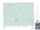
Maps showing Matabitchuan River, Timiskaming, Ontario
Matabitchuan River is a River located in Timiskaming, Ontario and has an elevation of 230 meters.
- Latitude: 47° 7' 45'' North (decimal: 47.1291666)
- Longitude: 79° 27' 42'' West (decimal: -79.4616666)
- Topography Feature Category: River
- Geographical Feature: River
- Canadian Province/Territory: Ontario
- Elevation: 230 meters
- Location: Timiskaming
- Atlas of Canada Locator Map: Matabitchuan River
- GPS Coordinate Locator Map: Matabitchuan River Lat/Long
Matabitchuan River NTS Map Sheets