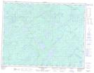
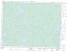
Maps showing Max Creek, Thunder Bay, Ontario
Max Creek is a River located in Thunder Bay, Ontario and has an elevation of 423 meters.
- Latitude: 49° 15' 45'' North (decimal: 49.2625000)
- Longitude: 89° 18' 9'' West (decimal: -89.3024999)
- Topography Feature Category: River
- Geographical Feature: Creek
- Canadian Province/Territory: Ontario
- Elevation: 423 meters
- Location: Thunder Bay
- Atlas of Canada Locator Map: Max Creek
- GPS Coordinate Locator Map: Max Creek Lat/Long
Max Creek NTS Map Sheets