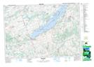
Maps showing McBurney's Hill, Durham, Ontario
McBurney's Hill is a Mountain located in Durham, Ontario and has an elevation of 170 meters.
- Latitude: 44° 1' 47'' North (decimal: 44.0297222)
- Longitude: 78° 20' 50'' West (decimal: -78.3472222)
- Topography Feature Category: Mountain
- Geographical Feature: Hill
- Canadian Province/Territory: Ontario
- Elevation: 170 meters
- Location: Durham
- Atlas of Canada Locator Map: McBurney's Hill
- GPS Coordinate Locator Map: McBurney's Hill Lat/Long
McBurney's Hill NTS Map Sheets