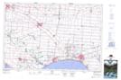
Maps showing McClean Drain, Essex, Ontario
McClean Drain is a Hydraulic construction located in Essex, Ontario and has an elevation of 184 meters.
- Latitude: 42° 7' 24'' North (decimal: 42.1233333)
- Longitude: 82° 58' 46'' West (decimal: -82.9794444)
- Topography Feature Category: Hydraulic construction
- Geographical Feature: Drain
- Canadian Province/Territory: Ontario
- Elevation: 184 meters
- Location: Essex
- Atlas of Canada Locator Map: McClean Drain
- GPS Coordinate Locator Map: McClean Drain Lat/Long