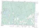
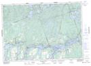
Maps showing McCoy Bay, Peterborough, Ontario
McCoy Bay is a Bay located in Peterborough, Ontario and has an elevation of 281 meters.
- Latitude: 44° 40' 53'' North (decimal: 44.6813888)
- Longitude: 78° 0' 7'' West (decimal: -78.0019444)
- Topography Feature Category: Bay
- Geographical Feature: Bay
- Canadian Province/Territory: Ontario
- Elevation: 281 meters
- Location: Peterborough
- Atlas of Canada Locator Map: McCoy Bay
- GPS Coordinate Locator Map: McCoy Bay Lat/Long
McCoy Bay NTS Map Sheets