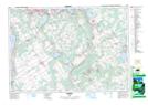
Maps showing Mount Stephen, Simcoe, Ontario
Mount Stephen is a Unincorporated area located in Simcoe, Ontario and has an elevation of 189 meters.
- Latitude: 44° 44' 48'' North (decimal: 44.7466666)
- Longitude: 79° 34' 53'' West (decimal: -79.5813888)
- Topography Feature Category: Unincorporated area
- Geographical Feature: Dispersed Rural Community
- Canadian Province/Territory: Ontario
- Elevation: 189 meters
- Location: Simcoe
- Atlas of Canada Locator Map: Mount Stephen
- GPS Coordinate Locator Map: Mount Stephen Lat/Long
Mount Stephen NTS Map Sheets