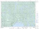
Maps showing Mowat Lake, Sudbury, Ontario
Mowat Lake is a Lake located in Sudbury, Ontario and has an elevation of 355 meters.
- Latitude: 46° 51' 51'' North (decimal: 46.8641666)
- Longitude: 80° 56' 51'' West (decimal: -80.9475000)
- Topography Feature Category: Lake
- Geographical Feature: Lake
- Canadian Province/Territory: Ontario
- Elevation: 355 meters
- Location: Sudbury
- Atlas of Canada Locator Map: Mowat Lake
- GPS Coordinate Locator Map: Mowat Lake Lat/Long