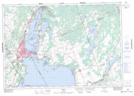
Maps showing Mulley Point, Ontario
Mulley Point is a Cape located in Ontario.
- Latitude: 44° 33' 47'' North (decimal: 44.5631000)
- Longitude: 79° 18' 32'' West (decimal: -79.3088999)
- Topography Feature Category: Cape
- Geographical Feature: Point
- Canadian Province/Territory: Ontario
- GPS Coordinate Locator Map: Mulley Point Lat/Long
Mulley Point NTS Map Sheets