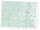
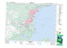
Maps showing Murillo, Thunder Bay, Ontario
Murillo is a Unincorporated area located in Thunder Bay, Ontario and has an elevation of 284 meters.
- Latitude: 48° 24' 43'' North (decimal: 48.4119444)
- Longitude: 89° 30' 13'' West (decimal: -89.5036111)
- Topography Feature Category: Unincorporated area
- Geographical Feature: Dispersed Rural Community
- Canadian Province/Territory: Ontario
- Elevation: 284 meters
- Location: Thunder Bay
- Atlas of Canada Locator Map: Murillo
- GPS Coordinate Locator Map: Murillo Lat/Long
Murillo NTS Map Sheets