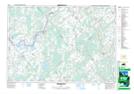
Maps showing Murphy Drain, Grenville, Ontario
Murphy Drain is a Hydraulic construction located in Grenville, Ontario and has an elevation of 98 meters.
- Latitude: 45° 0' 54'' North (decimal: 45.0149999)
- Longitude: 75° 43' 43'' West (decimal: -75.7286111)
- Topography Feature Category: Hydraulic construction
- Geographical Feature: Drain
- Canadian Province/Territory: Ontario
- Elevation: 98 meters
- Location: Grenville
- Atlas of Canada Locator Map: Murphy Drain
- GPS Coordinate Locator Map: Murphy Drain Lat/Long
Murphy Drain NTS Map Sheets