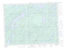
Maps showing Murray Creek, Ontario
Murray Creek is a River located in Ontario.
- Latitude: 48° 14' 00'' North (decimal: 48.2332999)
- Longitude: 84° 7' 12'' West (decimal: -84.1199999)
- Topography Feature Category: River
- Geographical Feature: Creek
- Canadian Province/Territory: Ontario
- GPS Coordinate Locator Map: Murray Creek Lat/Long
Murray Creek NTS Map Sheets