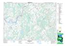
Maps showing North Kemptville Creek, Leeds, Ontario
North Kemptville Creek is a River located in Leeds, Ontario.
- Latitude: 44° 53' 52'' North (decimal: 44.8978000)
- Longitude: 75° 40' 59'' West (decimal: -75.6831000)
- Topography Feature Category: River
- Geographical Feature: Creek
- Canadian Province/Territory: Ontario
- Location: Leeds
- GPS Coordinate Locator Map: North Kemptville Creek Lat/Long
North Kemptville Creek NTS Map Sheets