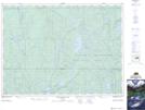
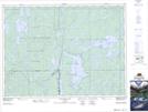
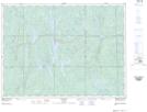
Maps showing North Lady Evelyn River, Timiskaming, Ontario
North Lady Evelyn River is a River located in Timiskaming, Ontario and has an elevation of 398 meters.
- Latitude: 47° 20' 51'' North (decimal: 47.3474999)
- Longitude: 80° 29' 5'' West (decimal: -80.4847000)
- Topography Feature Category: River
- Geographical Feature: River
- Canadian Province/Territory: Ontario
- Elevation: 398 meters
- Location: Timiskaming
- Atlas of Canada Locator Map: North Lady Evelyn River
- GPS Coordinate Locator Map: North Lady Evelyn River Lat/Long
North Lady Evelyn River NTS Map Sheets