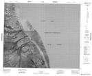
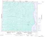
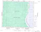
Maps showing Nowashe Creek, Kenora, Ontario
Nowashe Creek is a River located in Kenora, Ontario.
- Latitude: 54° 6' 2'' North (decimal: 54.1005555)
- Longitude: 82° 19' 53'' West (decimal: -82.3313888)
- Topography Feature Category: River
- Geographical Feature: Creek
- Canadian Province/Territory: Ontario
- Location: Kenora
- Atlas of Canada Locator Map: Nowashe Creek
- GPS Coordinate Locator Map: Nowashe Creek Lat/Long
Nowashe Creek NTS Map Sheets
043G10 No Title Topographic Map at 1:50,000 scale
043G14 Nowashe Lake Topographic Map at 1:50,000 scale
043G15 No Title Topographic Map at 1:50,000 scale
043G16 No Title Topographic Map at 1:50,000 scale
043J01 No Title Topographic Map at 1:50,000 scale
043G Ekwan River Topographic Map at 1:250,000 scale
043J Lakitusaki River Topographic Map at 1:250,000 scale