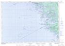
Maps showing O'Donnell Channel, Muskoka, Ontario
O'Donnell Channel is a Channel located in Muskoka, Ontario and has an elevation of 177 meters.
- Latitude: 45° 4' 25'' North (decimal: 45.0736111)
- Longitude: 80° 6' 6'' West (decimal: -80.1016666)
- Topography Feature Category: Channel
- Geographical Feature: Channel
- Canadian Province/Territory: Ontario
- Elevation: 177 meters
- Location: Muskoka
- Atlas of Canada Locator Map: O'Donnell Channel
- GPS Coordinate Locator Map: O'Donnell Channel Lat/Long
O'Donnell Channel NTS Map Sheets