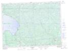
Maps showing Ogidaki, Algoma, Ontario
Ogidaki is a Unincorporated area located in Algoma, Ontario and has an elevation of 368 meters.
- Latitude: 46° 57' 34'' North (decimal: 46.9594444)
- Longitude: 84° 12' 35'' West (decimal: -84.2097222)
- Topography Feature Category: Unincorporated area
- Geographical Feature: Railway Point
- Canadian Province/Territory: Ontario
- Elevation: 368 meters
- Location: Algoma
- Atlas of Canada Locator Map: Ogidaki
- GPS Coordinate Locator Map: Ogidaki Lat/Long
Ogidaki NTS Map Sheets