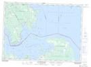
Maps showing Old Fort St. Joe Point, Algoma, Ontario
Old Fort St. Joe Point is a Cape located in Algoma, Ontario and has an elevation of 176 meters.
- Latitude: 46° 3' 44'' North (decimal: 46.0622222)
- Longitude: 83° 56' 42'' West (decimal: -83.9449999)
- Topography Feature Category: Cape
- Geographical Feature: Point
- Canadian Province/Territory: Ontario
- Elevation: 176 meters
- Location: Algoma
- Atlas of Canada Locator Map: Old Fort St. Joe Point
- GPS Coordinate Locator Map: Old Fort St. Joe Point Lat/Long
Old Fort St. Joe Point NTS Map Sheets