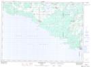
Maps showing Old Spring Bay, Manitoulin, Ontario
Old Spring Bay is a Unincorporated area located in Manitoulin, Ontario and has an elevation of 202 meters.
- Latitude: 45° 44' 48'' North (decimal: 45.7466666)
- Longitude: 82° 14' 56'' West (decimal: -82.2488888)
- Topography Feature Category: Unincorporated area
- Geographical Feature: Locality
- Canadian Province/Territory: Ontario
- Elevation: 202 meters
- Location: Manitoulin
- Atlas of Canada Locator Map: Old Spring Bay
- GPS Coordinate Locator Map: Old Spring Bay Lat/Long
Old Spring Bay NTS Map Sheets