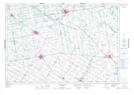
Maps showing Olivet, Wellington, Ontario
Olivet is a Unincorporated area located in Wellington, Ontario and has an elevation of 425 meters.
- Latitude: 43° 51' 10'' North (decimal: 43.8527777)
- Longitude: 80° 39' 36'' West (decimal: -80.6599999)
- Topography Feature Category: Unincorporated area
- Geographical Feature: Dispersed Rural Community
- Canadian Province/Territory: Ontario
- Elevation: 425 meters
- Location: Wellington
- Atlas of Canada Locator Map: Olivet
- GPS Coordinate Locator Map: Olivet Lat/Long
Olivet NTS Map Sheets