Canada Topographic Maps

Pashkokogan River Topo Maps

Topography maps and Latitude/Longitude Location

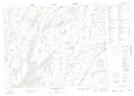
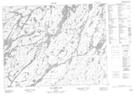
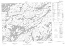
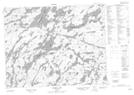
Maps showing Pashkokogan River, Thunder Bay, Ontario

Pashkokogan River is a River located in Thunder Bay, Ontario and has an elevation of 379 meters.

  • Latitude: 51° 7' 27'' North   (decimal: 51.1241666)
  • Longitude: 90° 4' 58'' West   (decimal: -90.0827777)
  • Topography Feature Category: River
  • Geographical Feature: River
  • Canadian Province/Territory: Ontario
  • Elevation: 379 meters
  • Location: Thunder Bay
  • Atlas of Canada Locator Map: Pashkokogan River
  • GPS Coordinate Locator Map: Pashkokogan River Lat/Long

Pashkokogan River NTS Map Sheets

052J09 Neverfreeze Lake Topographic Map at 1:50,000 scale

052J10 De Lesseps Lake Topographic Map at 1:50,000 scale

052J15 Miniss Lake Topographic Map at 1:50,000 scale

052J16 Mccrea Lake Topographic Map at 1:50,000 scale

052O01 Osnaburgh House Topographic Map at 1:50,000 scale

052J Sioux Lookout Topographic Map at 1:250,000 scale

052O Lake St Joseph Topographic Map at 1:250,000 scale

 
Buy Topographic Maps DVD
Newsletter Sign-up

Yes, I want to receive map store discounts.


Bookmark and Share