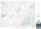
Maps showing Payne River, Russell; Stormont, Ontario
Payne River is a River located in Russell; Stormont, Ontario and has an elevation of 77 meters.
- Latitude: 45° 14' 20'' North (decimal: 45.2388888)
- Longitude: 75° 7' 52'' West (decimal: -75.1311111)
- Topography Feature Category: River
- Geographical Feature: River
- Canadian Province/Territory: Ontario
- Elevation: 77 meters
- Location: Russell; Stormont
- Atlas of Canada Locator Map: Payne River
- GPS Coordinate Locator Map: Payne River Lat/Long
Payne River NTS Map Sheets