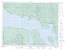
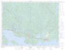
Maps showing Pays Plat River, Thunder Bay, Ontario
Pays Plat River is a River located in Thunder Bay, Ontario and has an elevation of 403 meters.
- Latitude: 48° 52' 45'' North (decimal: 48.8791666)
- Longitude: 87° 33' 30'' West (decimal: -87.5583333)
- Topography Feature Category: River
- Geographical Feature: River
- Canadian Province/Territory: Ontario
- Elevation: 403 meters
- Location: Thunder Bay
- Atlas of Canada Locator Map: Pays Plat River
- GPS Coordinate Locator Map: Pays Plat River Lat/Long
Pays Plat River NTS Map Sheets
042D13 Rossport Topographic Map at 1:50,000 scale
042D14 Schreiber Topographic Map at 1:50,000 scale
042E03 Dickison Lake Topographic Map at 1:50,000 scale
042E04 Gurney Lake Topographic Map at 1:50,000 scale
042D Schreiber Topographic Map at 1:250,000 scale
042E Longlac Topographic Map at 1:250,000 scale
042D14 Schreiber Topographic Map at 1:50,000 scale
042E03 Dickison Lake Topographic Map at 1:50,000 scale
042E04 Gurney Lake Topographic Map at 1:50,000 scale
042D Schreiber Topographic Map at 1:250,000 scale
042E Longlac Topographic Map at 1:250,000 scale