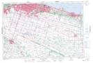
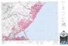
Maps showing Pleasant Valley, Wentworth, Ontario
Pleasant Valley is a Unincorporated area located in Wentworth, Ontario and has an elevation of 108 meters.
- Latitude: 43° 15' 16'' North (decimal: 43.2544444)
- Longitude: 79° 57' 40'' West (decimal: -79.9611111)
- Topography Feature Category: Unincorporated area
- Geographical Feature: Urban Community
- Canadian Province/Territory: Ontario
- Elevation: 108 meters
- Location: Wentworth
- Atlas of Canada Locator Map: Pleasant Valley
- GPS Coordinate Locator Map: Pleasant Valley Lat/Long
Pleasant Valley NTS Map Sheets