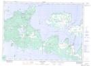
Maps showing Portage Point Spit, Manitoulin, Ontario
Portage Point Spit is a Cape located in Manitoulin, Ontario.
- Latitude: 45° 53' 3'' North (decimal: 45.8841666)
- Longitude: 82° 46' 7'' West (decimal: -82.7686111)
- Topography Feature Category: Cape
- Geographical Feature: Spit
- Canadian Province/Territory: Ontario
- Location: Manitoulin
- Atlas of Canada Locator Map: Portage Point Spit
- GPS Coordinate Locator Map: Portage Point Spit Lat/Long
Portage Point Spit NTS Map Sheets