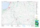
Maps showing Port Elgin, Bruce, Ontario
Port Elgin is a Unincorporated area located in Bruce, Ontario and has an elevation of 204 meters.
- Latitude: 44° 26' 13'' North (decimal: 44.4369444)
- Longitude: 81° 23' 27'' West (decimal: -81.3908333)
- Topography Feature Category: Unincorporated area
- Geographical Feature: Community
- Canadian Province/Territory: Ontario
- Elevation: 204 meters
- Location: Bruce
- Atlas of Canada Locator Map: Port Elgin
- GPS Coordinate Locator Map: Port Elgin Lat/Long