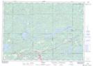
Maps showing Porter Lake, Sudbury, Ontario
Porter Lake is a Lake located in Sudbury, Ontario and has an elevation of 342 meters.
- Latitude: 46° 26' 25'' North (decimal: 46.4402777)
- Longitude: 81° 43' 4'' West (decimal: -81.7177777)
- Topography Feature Category: Lake
- Geographical Feature: Lake
- Canadian Province/Territory: Ontario
- Elevation: 342 meters
- Location: Sudbury
- Atlas of Canada Locator Map: Porter Lake
- GPS Coordinate Locator Map: Porter Lake Lat/Long