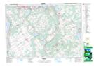
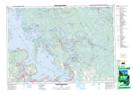
Maps showing Port McNicoll, Simcoe, Ontario
Port McNicoll is a Unincorporated area located in Simcoe, Ontario and has an elevation of 183 meters.
- Latitude: 44° 44' 58'' North (decimal: 44.7494444)
- Longitude: 79° 48' 38'' West (decimal: -79.8105555)
- Topography Feature Category: Unincorporated area
- Geographical Feature: Community
- Canadian Province/Territory: Ontario
- Elevation: 183 meters
- Location: Simcoe
- Atlas of Canada Locator Map: Port McNicoll
- GPS Coordinate Locator Map: Port McNicoll Lat/Long
Port McNicoll NTS Map Sheets