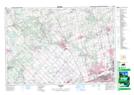
Maps showing Pottageville, York, Ontario
Pottageville is a Unincorporated area located in York, Ontario and has an elevation of 244 meters.
- Latitude: 43° 59' 31'' North (decimal: 43.9919444)
- Longitude: 79° 37' 23'' West (decimal: -79.6230555)
- Topography Feature Category: Unincorporated area
- Geographical Feature: Dispersed Rural Community
- Canadian Province/Territory: Ontario
- Elevation: 244 meters
- Location: York
- Atlas of Canada Locator Map: Pottageville
- GPS Coordinate Locator Map: Pottageville Lat/Long