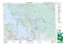
Maps showing Potters Landing, Muskoka, Ontario
Potters Landing is a Unincorporated area located in Muskoka, Ontario and has an elevation of 199 meters.
- Latitude: 44° 59' 25'' North (decimal: 44.9902777)
- Longitude: 79° 48' 46'' West (decimal: -79.8127777)
- Topography Feature Category: Unincorporated area
- Geographical Feature: Dispersed Rural Community
- Canadian Province/Territory: Ontario
- Elevation: 199 meters
- Location: Muskoka
- Atlas of Canada Locator Map: Potters Landing
- GPS Coordinate Locator Map: Potters Landing Lat/Long
Potters Landing NTS Map Sheets