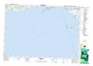
Maps showing Presqu'ile Provincial Park, Northumberland, Ontario
Presqu'ile Provincial Park is a Conservation area located in Northumberland, Ontario and has an elevation of 74 meters.
- Latitude: 43° 59' 38'' North (decimal: 43.9938888)
- Longitude: 77° 42' 47'' West (decimal: -77.7130555)
- Topography Feature Category: Conservation area
- Geographical Feature: Provincial Park
- Canadian Province/Territory: Ontario
- Elevation: 74 meters
- Location: Northumberland
- Atlas of Canada Locator Map: Presqu'ile Provincial Park
- GPS Coordinate Locator Map: Presqu'ile Provincial Park Lat/Long
Presqu'ile Provincial Park NTS Map Sheets